File:Carte LCGFr 2018.png

Size of this preview: 800 × 468 pixels. Other resolutions: 320 × 187 pixels | 1,514 × 885 pixels.
Original file (1,514 × 885 pixels, file size: 207 KB, MIME type: image/png)
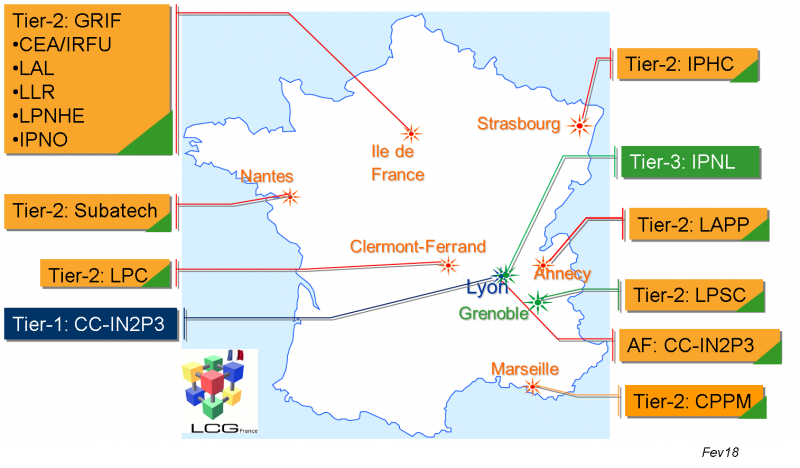
Maps of LGC-France sites as of 2018, with color coded boxes (blued for T1, orange for T2, green for T3 or T3 part of a T2)
File history
Click on a date/time to view the file as it appeared at that time.
| Date/Time | Thumbnail | Dimensions | User | Comment | |
|---|---|---|---|---|---|
| current | 10:30, 27 juin 2018 | | 1,514x885 (207 KB) | Lduflot (talk | contribs) | Maps of LGC-France sites as of 2018, with color coded boxes (blued for T1, orange for T2, green for T3 or T3 part of a T2) |
- You cannot overwrite this file.
Liens vers l'image
Aucune page ne contient cette image.